Mildura sits on the deep Quaternary sediments of the Murray Basin, where the Murray River has deposited layer upon layer of silty clays, loose sands, and occasional gravel lenses over millennia. The water table here often sits within 3 to 5 metres of the surface, and the Blanchetown Clay can show up at depth with unexpected stiffness contrasts. A standard borehole log gives you a point every 1.5 metres. A CPT truck pushed across a site in Mildura South or Nichols Point delivers a continuous resistance trace every 20 millimetres. That density of data changes how you design footings near the river and how you model liquefaction risk in sandy layers the driller might have missed. We run the cone push alongside SPT drilling on sites where the client wants both disturbed samples for lab classification and a high-resolution stratigraphic profile, and we frequently pair the CPT with seismic dilatometer work when shear wave velocity is needed for site class determination under AS 1170.4.
A CPT trace through Murray Basin sediments will show you the exact depth where the sand lens pinches out. A borehole log will just show you the 1.5-metre gap.
Site-specific factors
We worked a site off Benetook Avenue last year where the borehole log showed clean medium sand from 4 to 9 metres. The developer was ready to specify a shallow pad footing system. The CPT push revealed a 600-millimetre-thick soft clay seam at 7.2 metres that the SPT spoon had completely missed because the sampler crossed the layer in one blow count increment. That seam, undetected, would have created a differential settlement problem within the first two irrigation seasons. The CPT friction ratio spike at that depth flagged the layer immediately, and the pore pressure dissipation test confirmed it was draining slower than the surrounding sand. We redesigned the footing depth and avoided a costly remedial job. Mildura's floodplain deposits are notorious for these thin, discontinuous clay lenses, and skipping the continuous profile is the single most expensive shortcut a developer can take in this region. On larger commercial builds, we often integrate the CPT data with a liquefaction assessment to satisfy the geotechnical requirements of AS 1726.
Quick answers
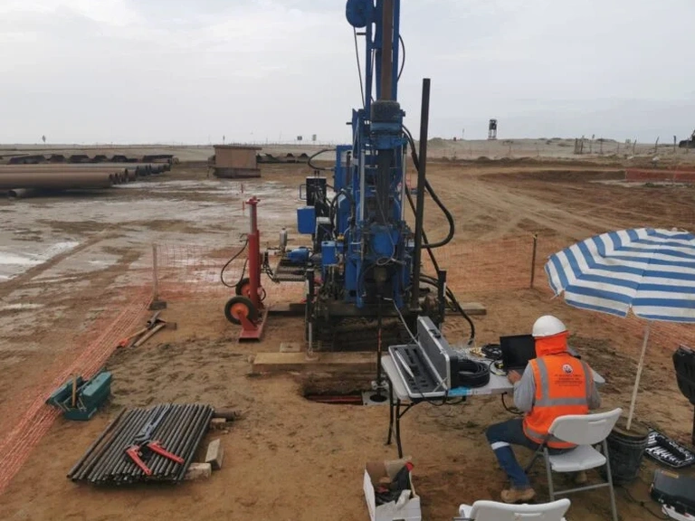
How deep can a CPT rig push in Mildura soils?
In the Murray Basin sediments around Mildura, our 20-tonne CPT truck typically reaches 25 to 30 metres before refusal. Refusal occurs when the cone hits a dense gravel layer, a thick calcrete band, or very stiff clay where the thrust capacity maxes out. On most residential and commercial sites in the Sunraysia region, we achieve the target depth without issue because the Quaternary deposits are predominantly sands, silts, and clays with only occasional cemented horizons.
What does a CPT test cost in Mildura?
Do I still need boreholes if I run CPT on my Mildura site?
CPT gives you a continuous strength and stratigraphy profile, but it does not recover a physical soil sample for laboratory testing. If your project needs Atterberg limits, particle size distribution, or triaxial shear strength, you will need at least one borehole or test pit to collect samples for the lab. Many Mildura projects combine one or two SPT boreholes for sampling with several CPT pushes to fill in the stratigraphic detail between borehole locations.
Can CPT detect the Blanchetown Clay layer beneath Mildura?
Yes, and it is one of the best tools for the job. The Blanchetown Clay shows up on a CPT trace as a sharp increase in tip resistance and sleeve friction, often with a drop in pore pressure response due to its low permeability. The continuous profile pinpoints the exact depth of the clay surface and its thickness, which is critical for designing deep footings or piles that bear within or below this stiff, overconsolidated layer. The friction ratio also helps distinguish the Blanchetown Clay from the overlying Shepparton Formation silts.